
Planning Your Trip | Know Your Trail | Conditions & Forecasts | Be Prepared & Equipped
Planning Your Trip to the Pemi Area
The Pemigewasset River Valley is on the western side of the White Mountains region of New Hampshire and is surrounded by recreational lands managed by both the United States Forest Service and New Hampshire State Parks in partnership with other organizations.
The following resources can help hikers decide where they want to hike in the area surrounding the Pemi Valley:

The White Mountains Visitor Center tourism website has information on local lodging, dining, and attractions, including suggested hikes.

The White Mountain National Forest in eastern New Hampshire and western Maine covers much of the White Mountains region. The Forest Service site contains suggested hikes, maps, and permit and fee information.

The New Hampshire State Parks website includes information on camping and other state parks including Crawford Notch State Park and Mount Washington State Park, both in the White Mountains.
Franconia Notch State Park is located in a spectacular mountain pass traversed by a unique parkway which extends from the Flume Gorge at the south to Cannon Mountain at the north. For eight miles, I-93 winds between the high peaks of the Kinsman and Franconia ridges. Although most of the mountain peaks that hikers strive to reach are located in White Mountain National Forest, the trailheads in this area are located in FNSP. New in 2018, FNSP is running a hiker shuttle between the Cannon Mountain parking area and key trailheads to alleviate parking congestion in the lots along I-93.
The Appalachian Mountain Club also performs routine trail maintenance throughout much of WMNF, runs a hiker shuttle, provides caretakers at key campsites, and operates a system of huts including Lonesome Lake, Greenleaf, Galehead, and Zealand Falls on the mountain ridges surrounding the Pemi Valley. The AMC publishes maps and trail guides for the White Mountains and local AMC staff at the Highland Center, mountain huts, and staffed campsites are usually knowledgeable on current trail conditions and the AMC maintains a list of weather and trail conditions at their facilities.
The Randolph Mountain Club maintains a network of nearly 102 miles of hiking trails, principally on the northern slopes of Mount Madison, Mount Adams, and Mount Jefferson in the Presidential range of the White Mountain National Forest, and on the Crescent Range in the town of Randolph, NH. The RMC also maintains two cabins, Crag Camp and Gray Knob; one lean-to, The Perch; and one Adirondack-style shelter, the Log Cabin. There are also four tent platforms at The Perch. All camps are available to the public on a first-come, first-served basis.
Know Your Trail
When planning a hike, it’s important to do your research ahead of time and know about the trail you’re taking so that you can be prepared and know what to expect. Before setting out, you should know the following five things about your route:
1. What trail you’re taking
Know the name of the trail and route you’re taking (especially if there are interconnecting trails), and what color blazes are used. This will help you stay on the correct trail.
2. Trailhead location and access
Some trailheads can be very crowded, so you may want to arrive early, or be aware you may need to park a distance away. Also, some backcountry trailheads are on seasonal roads that may be closed during certain times of day or times of year, meaning you may wind up hiking an extra mile or two along a dirt road to get to the trail.
3. Trail length & elevation gain
Know the mileage of the route you’re taking as well as the elevation gain (Note: listed elevation for a hike typically refers to the distance between the highest point on the hike and sea level. Elevation gain specifically refers to the gain in elevation from the beginning of the hike to its highest point.)
4. How difficult is the trail?
Trail difficulty is hard to measure objectively, since what is difficult is always going to be relative. But there are some factors to consider for what’s likely to make a trail more or less difficult to hike:
- Steepness – determined by elevation gain / length. TrailsNH has a useful hiking difficulty calculator to help you get an idea of the overall grade of the trail based on these criteria.
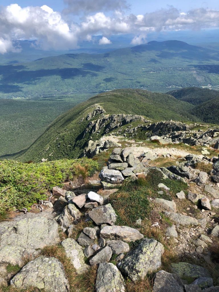
- Terrain – Most of the terrain in the White Mountains is rugged with plenty of rocks and tree roots, but some trails moreso than others, featuring scrambles where you will need to use your hands as well as your feet.
- Trail Conditions – The constantly changing weather in the White Mountains means the conditions of the trail — muddy, icy, snowy, etc. — will be in constant flux. See resources for trail conditions below.
5. What is your expected hike duration?
Research the amount of time your planned route is projected to take, and factor in your personal pace, as well as current trail conditions that may affect your speed. All hikers have different paces, and if you aren’t sure about yours, err on the side of giving yourself more time than you expect to need so you aren’t caught out in the wilderness after sundown.

Conditions & Forecasts
The White Mountains are home to some of the “worst weather in the world”, with rapidly changing microclimates and high wind speeds. Nature is a powerful force here, and not one to be underestimated.
Hikers must remember that mountains create their own weather and the conditions high up on the mountain ridges may be significantly worse than those at the trailhead or “back at home” further South. The smart hiker will check with rangers and other local resources to verify trail and weather conditions before setting out and will turn around immediately if trail or weather conditions are deteriorating beyond what was expected and what the party is prepared to deal with.
The following resources can help hikers determine current trail and weather conditions in the area surrounding the Pemi Valley:


Be Prepared & Equipped
Adequate and appropriate clothing and gear for the outing you’re undertaking can prevent the need for a rescue, or in severe circumstances, keep you alive until rescue can reach you. Make sure to research what you’ll need in order to be safe in the weather and conditions you are hiking in, and pack accordingly.
The Ten Essentials:
In any outing into backcountry, it’s recommended that you bring the ‘Ten Essentials’ to ensure your safety and self-sufficiency in the event of an emergency:
Winter Hiking Gear:
Winter hiking in the White Mountains can be beautiful, but not without risk. In addition to dressing warmly, having appropriate winter boots, and packing additional layers, you will want to make sure you have appropriate gear for winter terrain.
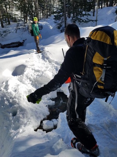
Snowshoes or Skis for deep snow
Especially right after a fresh snowfall, you will need shoeshoes or skis. This is both a matter of etiquette and of safety. Snowshoes help to pack down snow and smooth out the trail for others to use, compressing it into a dense and walkable layer. Walking through deep snow in bare boots, however, punches deep “post holes” in the snow; this will exhaust you, slow you down, and drain your energy faster, all of which can compromise your safety. In addition, “post-holing” makes it harder to pack down the trail, and renders it more dangerous for others by creating hazardous terrain for those wearing adequate gear.
Microspikes or Trail Crampons for compacted snow and ice
If the trail is compacted but icy, or in the shoulder seasons where thawing and freezing of snowmelt can create icy floes down the trail, you will want light traction to maintain your footing. Microspikes are the hiking equivalent of putting chains on your tires in winter — they provide grip on slippery terrain and are essential for winter hiking safety in New Hampshire.